April 10, 2009: Severe weather outbreak strikes our region…
It has been a long 24 hours. Numerous severe thunderstorms struck southeast MO, South IL, West KY, West TN (and many Aciclovir without prescription other areas). McCracken County had winds of 80+ mph and Massac County did as well. Lot of damage to structures.
Numerous counties had hailstorms. We had several hailstorms in McCracken County. Graves County had a large supercell with a hook echo pass south of Mayfield. A wall cloud was reported.
Rough 24 hours. Glad it is over.
Spent a lot of time over the last few days at the farm. Jason and Jess Darnall helped put weather instruments up and trench some ditches. Looks like everything is moving along!
Some photos and images from the last few Lithium online days…
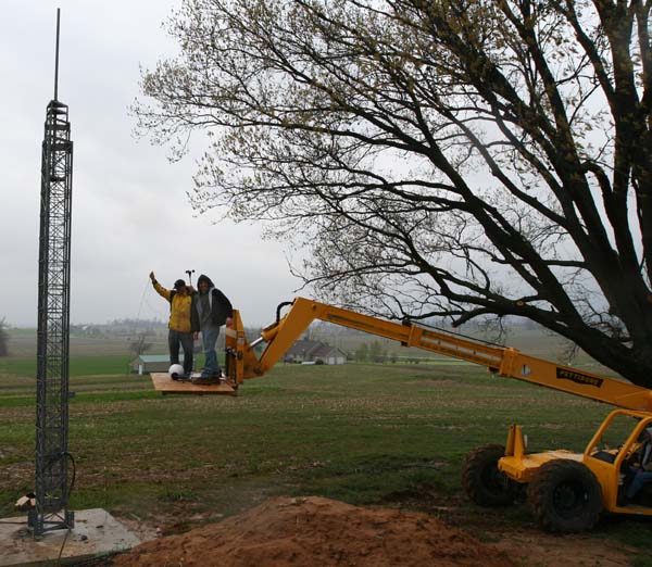
Putting the anemometer on top of the big tower
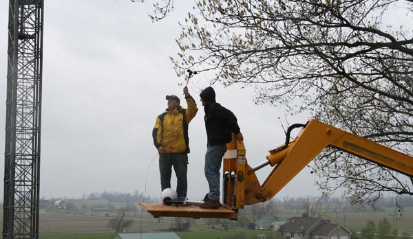
Jason Darnall and myself – going higher!
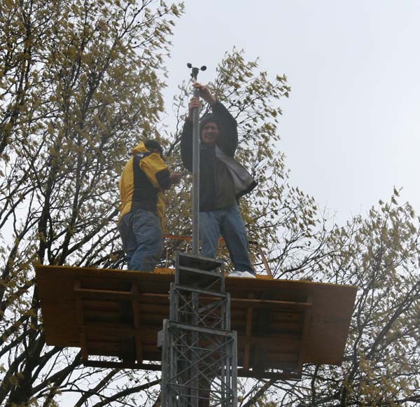
In the rain even – and wind!!!!!
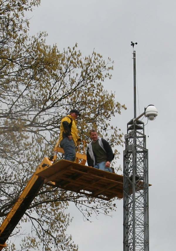
And the tower cam!
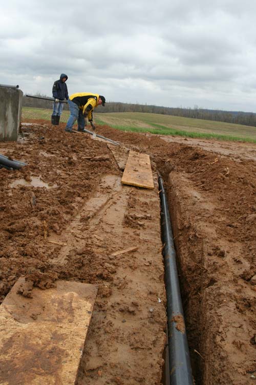
Trenching the wires for the weather instruments.
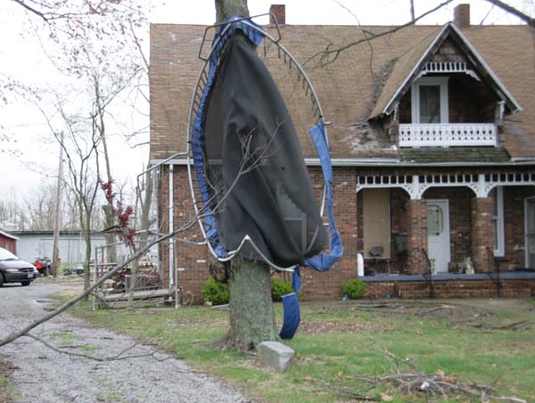
Damage in Massac County – storm hit at 1:15 AM in the morning. Lady said it sounded like a freight train.
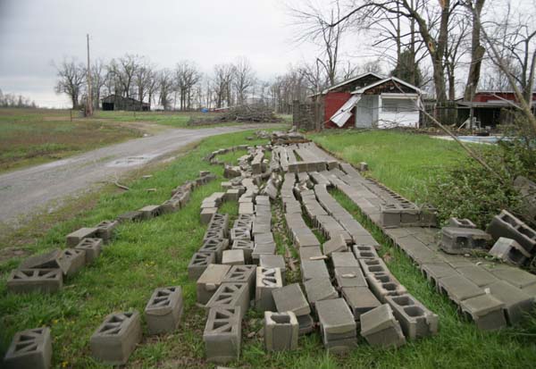
Concrete brick wall was destroyed.
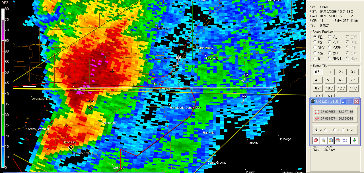
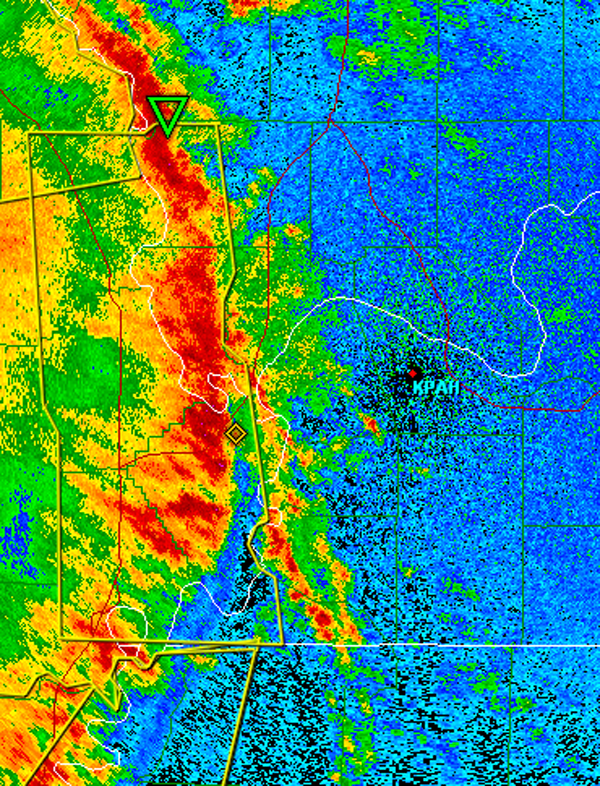
Tornadic supercell that passed in Graves County, Kentucky – just south of Mayfield, Kentucky (where my sister and mom lives)
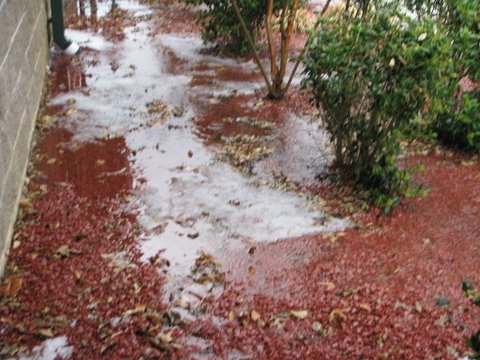
Hail in Reidland. Photo sent from Reidland Fire Department. Photo by Justin Adams

Tony Crouch photograph – hailstorm in Mayfield, KY – photo sent at 2 AM
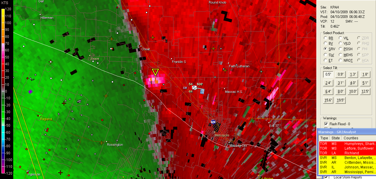
This was the storm that hit us at 1-2 AM in purchase Indocin the morning. Widespread winds of 50-70 mph were reported across our counties.
Squall line hitting our counties at 1-2 AM
 Print This Post
|
Print This Post
|  Email This Post


 Posts
Posts


