My two towers are now up and ready for instruments and antennas where to buy Indocin to be installed!
Barry and his misoprostol online crew came by a few days ago and placed the 10 meter tower up – this is for my weather instruments – then the 55′ tower was installed – that will be for the tower cam and additional antennas. So, everything is moving right along!

Large tower is going up


Small tower – for weather instruments
buy Vermox
March 25th, 2009
Posted by
admin |
Uncategorized |
no comments
 Print This Post
|
Print This Post
|  Email This Post
Jason and Joey (works with Jason) helped put the weather instruments up at the Reidland Fire Station. Looks like they are working just fine tonight. Same with the instruments on the west part of the county. They are working as well. Links below  These are the new emergency management weather instruments that the county bought. We have one more to put up – waiting to here from our director, though, on that one.


West part of county
http://www.wunderground.com/weatherstation/WXDailyHistory.asp?ID=KKYKEVIL2
http://www.wunderground.com/swf/Rapid_Fire.swf?units=english&station=KKYKEVIL2
Rapid Refresh
Reidland
http://www.wunderground.com/swf/Rapid_Fire.swf?units=english&station=KKYKEVIL2
http://www.wunderground.com/swf/Rapid_Fire.swf?units=english&station=KKYPADUC9
Rapid refresh

Jason Darnall working on the weather instruments for the Reidland, KY Fire Station
We had heavy rain overnight. cheap albuterol Some thunderstorms. I picked up 1.36" here in Lone Oak. Not a bad rainfall. We needed it. Lot of grass fires of late.

Radar from last night – 8:45 PM
More thunderstorms are likely Friday into Saturday. A major outbreak is expected across portions of the southern United States. Hoping our region will be spared the buy Premarin worst.
GFS is furthest west with the track of the primary low. It has been fairly consistent with showing a track through Arkansas and Southeast MO – has actually trended a bit west over the last few runs. NAM is further to the south and east and takes the primary low through MS. GFS seems to occlude fairly early, as well.
Several rounds of severe weather will be possible with this system and this will make Fridays forecast more difficult. Complicating matters will be system 1 tonight – system 2 tomorrow night and Friday morning and then round 3 on Friday afternoon into Saturday.
The models have been slowly catching up with how the low level jet will unfold – with SREF showing high numbers on the "tornado ingredients" prog for the last few days. SREF has a bullseye over Southeast AR/LA/MS into AL with the above mentioned prog. Seems to peak Friday night (late) over LA and southwest MS and then a second peak between 3 pm and 10 pm over much of MS and extending northward into West TN and then into Alabama, as well. SREF is showing 30-50% bullseye for Friday. Again it has been showing this for several days now – with little change in numbers. I always find it more important to see consistent numbers – day after day leading up to an event.
Track of the low is critical for the placement of the highest tornado potential. Winds should back to the southeast during Friday afternoon over portions of MS and AL – TN. 850 wind fields of 40-60 knots – depending on your model of choice – are showing up over the same region. A strong 500 mb wind max also pushes into the TN Valley on Friday night. Speeds of 100-120 knots are indicated by the GFS over the Arklatex region into southeast AR/North LA. Neutral tilt turns negative on Friday night into Saturday.
CAPE readings have been consistently showing up in the 1000-3000+ range over a large portion of the SPC outlooked area for several days now. GFS has been indicating very high CAPE readings for a number of days now and has shown little change this afternoon. Dew point readings from the middle to upper 60s (even some 70s) push all the way into Arkansas/Mississippi on most models.
There appears to be some question on just how much wind shear is realized with differing opinions from one model to the next. If the low actually does deepen as being depicted by the GFS and some other models then common sense would say that a strong low level jet will develop in response to the deepening low.
I would pick a line from Memphis, TN to Florence, AL and then back down towards Jackson, MS and perhaps southeast AR. This appears to be where the best dynamics will come together, although northern LA and southern AR could see higher CAPE values. Timing of day could be an issue, as well. Although the warm sector is rather broad and the potential for several lines and areas of severe weather will exist. The Memphis, TN – Jackson, MS – Birmingham, AL NWS Offices have been hitting the potential pretty hard in the area forecast discussions and hazardous weather outlooks.
If the low does move further south and east then I would prob try a Jackson – Mobile – Birmingham triangle.
Highest instability being progged for Friday afternoon and evening is actually over AR and Northern LA – CAPE values exceeding 3000 are and have been showing up on the models. Potential for some very large hail will exist in portions of the SPC outlook. Tough chasing in AR, though.
Another question is whether or not a couple of supercells can form closer to the low and along the warm front – if that were to happen then the tornado risk would be enhanced closer to NE AR and into the MO Bootheel and NW TN (assuming the track of the low is close to what the GFS is indicating). Obviously this has greater implications for my region and has been of interest to me since last Friday. Right now it appears most of the KPAH region will be out of the highest risk zone and perhaps will have to deal with elevated convection or some secondary risk on Saturday (see NAM with spiked instability for Saturdays event).
KGWO (BUFKIT) in MS shows CAPE values of 2700+ at 7 pm and 2500+ at 10 pm/ KI of 40+/ sweat index of 600+/ TT of 55+/ BRN of 21-23/ 850 winds increase from 18 knots at 1 pm to 55+ knots by 7-10 pm period/ significant tornado index is greater than 5/ supercell index is greater than 6/ all between the same hours mentioned above. Also noticed on BUFKIT that winds at low levels could actually be east/southeast with plenty of turning with height.
Way too early to determine how Thursday nights activity will come into play – will there still be a lot of cloud debris around on Friday morning or will it clear out of the region in time for destabilization to occur on Friday morning into the afternoon hours? Placement of boundaries? Will the low actually deepen as much as the GFS is indicating? Another question on the table.
A second peak of instability is being shown by the NAM over KY and TN on Saturday afternoon – just southeast of the deep low.
The potential for Friday’s event is pretty high – the signal for this event has been on the models for more than 5 days now. It appears SPC is talking about at least a moderate risk and hinted at even higher for Friday.
Good luck to anyone chasing – not the best area to chase storms.
EDIT: Developmental RUC now comes in with a low even further west and stronger – showing the primary low passing into eastern Oklahoma. 0z NAM is now further east and south taking the main low through southeast AR and into MS. Cutting the differences between all models would give a track through AR and into MO/IL/KY.
Disulfiram online
March 25th, 2009
Posted by
admin |
Uncategorized |
no comments
Print This Post
| Email This Post
A rather calm weather story across our region. A band of showers moved through the region earlier today. Paducah only received 0.03" of rainfall. It appears the misoprostol buy next few days should be nice, as well. We have actually had high temperatures into the middle 70s over the last few days. Nice change of pace!
The next chance for showers and thunderstorms will likely come next Tuesday into Wednesday. Too far out to know whether we will see a slight risk of severe thunderstorms. There is buy Cytotec cheap an outside chance of showers along the warm front on Sunday, as well.
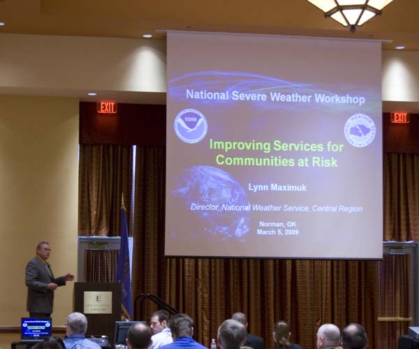
The NWS in Paducah, Kentucky held their severe weather workshop today. Topics included the recent ice storm and lessons Propranolol 20mg learned from the event. Great discussion all the way around!
March 19th, 2009
Posted by
admin |
Uncategorized |
no comments
Print This Post
| Email This Post
Asacol online
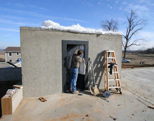
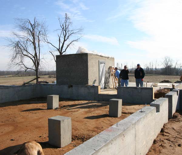
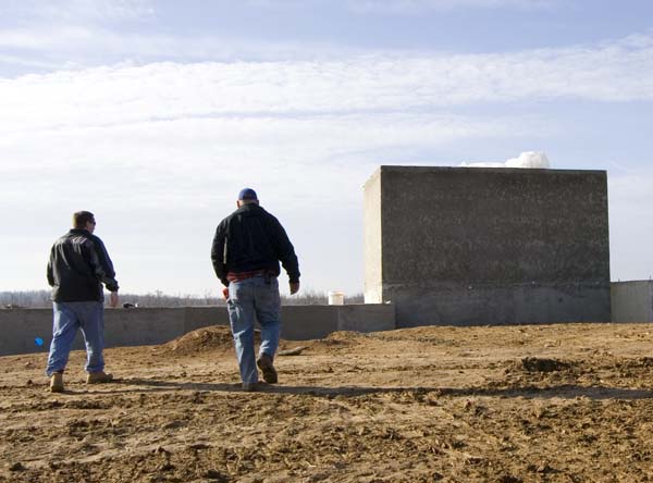
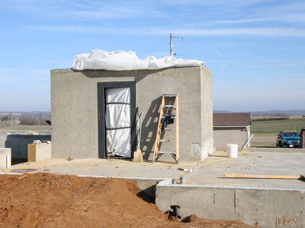
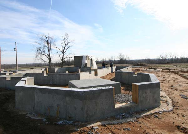
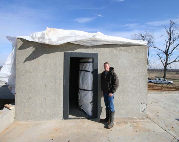
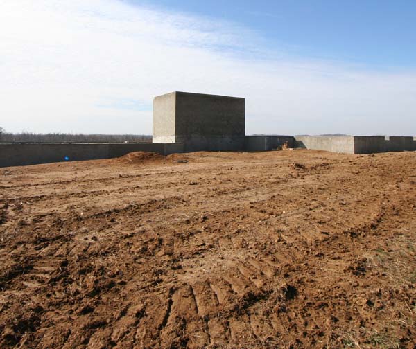
I was at the farm Buy Natrexone today and the tornado shelter is finished. For that matter the foundation is finished, as well! So, we are ready to start building. Looks like they will be ordering the wood this week and will start building next week.  Lot of decisions to make in the coming weeks. I am sure things will be busy busy!
buy Retin-A Some photos from today…
March 9th, 2009
Posted by
admin |
Uncategorized |
no comments
Print This Post
| Email This Post
Severe thunderstorms moved through the region earlier this morning and afternoon. Several reports of tornadoes across Missouri, Illinois, Indiana, and Kentucky. Paducah had heavy rain and 50 mph winds. Most of the storm damage was too our north. Propranolol 20mg Seventeen tornadoes were reported across the Missouri and Ohio Valleys.
Looks Lasix online like more storms are possible on Tuesday.

Storms roll into Paducah at 1:30 PM
 Proscar online
Today’s severe weather reports
March 8th, 2009
Posted by
admin |
Uncategorized |
no comments
Print This Post
| Email This Post
Some great discussions today at the Severe Weather Workshop. Topics included the possibility of cheap Ventolin the NWS issuing probability warnings, how people respond to tornado warnings (or don’t respond), how the news media plays a role in distributing information before an outbreak, the importance of GIS and deciding what a storm may or may not impact, ensemble SREF forecasting, and much more! Fun topics and interesting! Interesting for those that love weather!!!! I would imagine a lot of people would be bored.
Cheap Sildenafil
Severe Weather Workshop
buy esomeprazole

Warnings based on probabilities instead of polygon regions
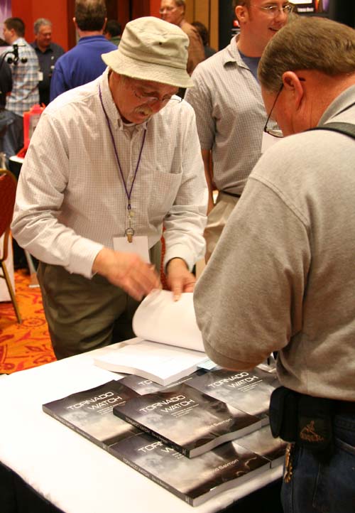
New book "Tornado Watch"
March 5th, 2009
Posted by
admin |
Uncategorized |
no comments
Print This Post
| Email This Post
I am glad I went with a forecast of a dusting to <1" for most of West KY. That is about what we received. Some areas buy isotretinoin received light accumulations – counties close to the Tennessee border. A lot of people were asking me about the snowfall potential. Apparently one local station was forecasting 4-6" for Paducah.
The Kentucky/Tennessee border counties did receive 1-3" of snow. Fulton, Kentucky reported 3.5" of snowfall. West Tennessee, however, received 5-12" of the white gold. Southeast Missouri also reported Indocin no prescription several inches of wet snow. Most of West Kentucky, however, received little or no accumulation.
It appears we will see warming temperatures this week. Active weather is expected to return to the region this coming weekend and into the second week of March. Severe weather is a possibility – along buy Propranolol online with heavy rain.
Today is the first day of meteorological spring! Severe weather season is upon us.
I will be heading to Norman, Oklahoma on Tuesday night. The National Severe Weather Workshop will be running from Wednesday through the weekend.
March 1st, 2009
Posted by
admin |
Uncategorized |
no comments
Print This Post
| Email This Post


 Posts
Posts


